360° Situational Awareness System (SAS)
- MIL-STD-810G
- MIL-STD-461E/F
- IP65 Rated
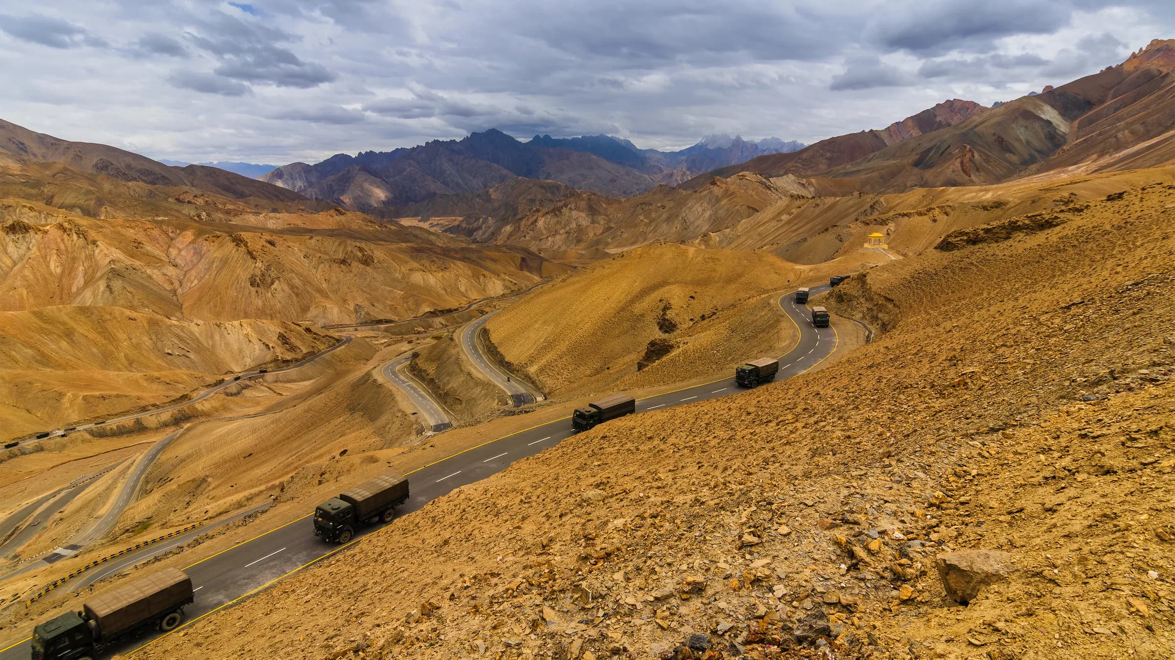
- 1% DT CEPGNSS-Denied Position Drift
- 15+ YearsProgram Life Support
- MIL-STD-810GEnvironmental Qualification
- 360°Panoramic Coverage
Built for Rugged, Connected Battlefield Awareness
Industrial-grade reliability, integrated sensing, and real-time operational intelligence.
GNSS-Resilient Navigation
Hybrid Land Navigation (HLNS)
Maintains continuity through GNSS interference or loss using sensor fusion and vehicle motion estimation.
360° Operator Confidence
Camera + AI Layer
Stitches synchronized views into a unified panorama and classifies potential threats in real time.
Core Components
 Hybrid Land Navigation (HLNS)GNSS-denied positioning continuity via sensor fusion and vehicle motion estimation.
 360° Camera SystemMulti-view imaging with real-time stitching for seamless situational overview.
 AI Threat DetectionReal-time object classification to highlight potential threats for operators.
The Navigation Core
SAS is powered by Aeron's Octantis 2 INS-GNSS — the field-proven navigation engine behind GNSS-denied positioning continuity.
High Reliability System
Field proven MIL Qualified INS-GNSS System suitable for very demanding and harsh requirements — part of various military programs.
GPS (GNSS) Denied Performance
Suitable for land navigation in GNSS compromised scenarios, assuring low position drift (1% DT CEP).
Proven Field-Performance
Part of key defence programmes since 2013, and supported for a programme life of 15+ years.
Odometer (ODO) Aiding
Accepts ground speed aiding over CAN (J1939 protocol) and over pulse odometer with configurable scale factor.
Device Diagnostics
Complete and Continuous Built-In-Test (CBIT) to monitor and inform the user of system health parameters, including sensor health.
Isolated Interfaces & Power Supply
Protects the device electronics from electromagnetic interference and transients on power and data lines.
Communication
Wide array of isolated interfaces and protocols, including Binary and NMEA over Ethernet, CAN, Serial RS422 and RS232.
High-Quality Tactical MEMS Sensors
Aeron's own IMU system incorporating high-performance MEMS sensors for exceptional GPS-denied performance in long-term outages.
Why This Solution
MIL-STD-810 Compliance
Vibration, shock, and environmental endurance.
Real-time Video Stitching
Seamless 360° panorama under motion.
AI-based Object Classification
Edge detection with operational prioritization.
GNSS-Denied Operation
Sustains navigation and awareness when GPS is compromised.
Edge-Optimized Processing
Low-latency inference for faster operator response.
Secure-by-Design Integration
Mission systems compatibility and robust interfaces.
Choose your navigation platform
SAS integrates with either of Aeron's tactical-grade INS platforms, depending on your performance and budget profile.
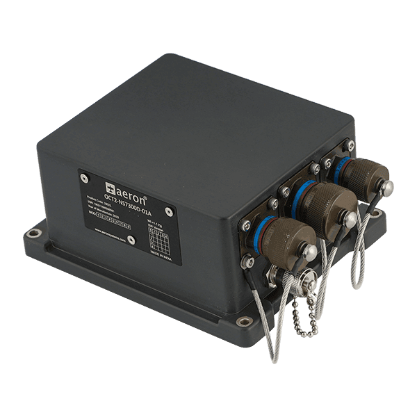
OCT2-INS-GNSS
Octantis 2 INS-GNSS
MEMS-Based
Rugged MEMS-based navigation with centimetre-level RTK positioning
- Horizontal Position
- <0.8 cm with RTK · 1.5 m CEP with GNSS
- Angular Rate Range
- ±450°/s
- Update Rate
- 100 Hz Nav · 200 Hz IMU
- Power Consumption
- <7 W · 12–32 V DC
- Weight
- <1.1 kg
- Environmental
- IP65 · MIL-STD-461F · MIL-STD-810G
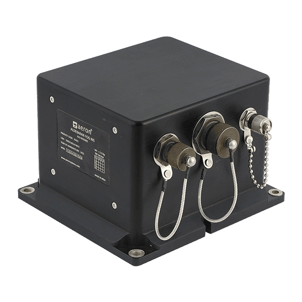
ALDEBARAN
Aldebaran FOG INS-GNSS
FOG-Grade
Fiber-optic gyro INS for superior pure-inertial performance
- Horizontal Position
- <0.8 cm with RTK · 1.5 m with GNSS
- Angular Rate Bias Instability
- 0.1°/hr (FOG-grade)
- Update Rate
- 100 Hz Nav · 200 Hz Raw
- Power Consumption
- <12 W · 12–32 V DC
- Weight
- <2.5 ± 0.05 kg
- Environmental
- IP65 · MIL-STD-461E · MIL-STD-810G
Documentation
SAS pairs with either of Aeron's tactical-grade navigation cores — download full specifications for your platform, or request a quote from our systems engineering team.
- Download
Octantis 2 INS-GNSS Datasheet
Datasheet, v2.2, updated 19 May 2026, 0.8 MB PDF
Aldebaran FOG INS-GNSS Datasheet
Datasheet, v1.1, updated 18 May 2026, 0.5 MB PDF
Contact
Ask for a price, or talk to one of our engineers about your platform or your plant.
Sales
Products, quotes and demos
Technical support
Help with an installed product
Careers
Jobs and applications
Offices
India
Head office and design centre, Pune
Plot No. 7, Lane No. 5, Laxman Nagar, Balewadi
Pune, Maharashtra 411045, India
Factory, Pune
Vivan Kohli Industrial Park, Shed No. 5, Gat No. 446
Old Pune-Mumbai Highway, Naigaon, Kanhe Phata, Talegaon
Pune, Maharashtra 412106, India
Sales and support, Bengaluru
First Floor, Building No. 11, Sai Anugraha
Jeevan Bhima Nagar Main Road
Bengaluru, Karnataka 560075, India
Sales and support, Vijayawada
Door No. 52-1/4-8D, Plot No. 9, 5th Cross Road
Veterinary Colony
Vijayawada, Andhra Pradesh 520008, India
International
Aeron Systems Pvt. Ltd., Sharjah
Saif Executive Office # P8-17-02
Sharjah Airport International Free Zone Authority
PO Box 8000, Sharjah, U.A.E.