Land Systems
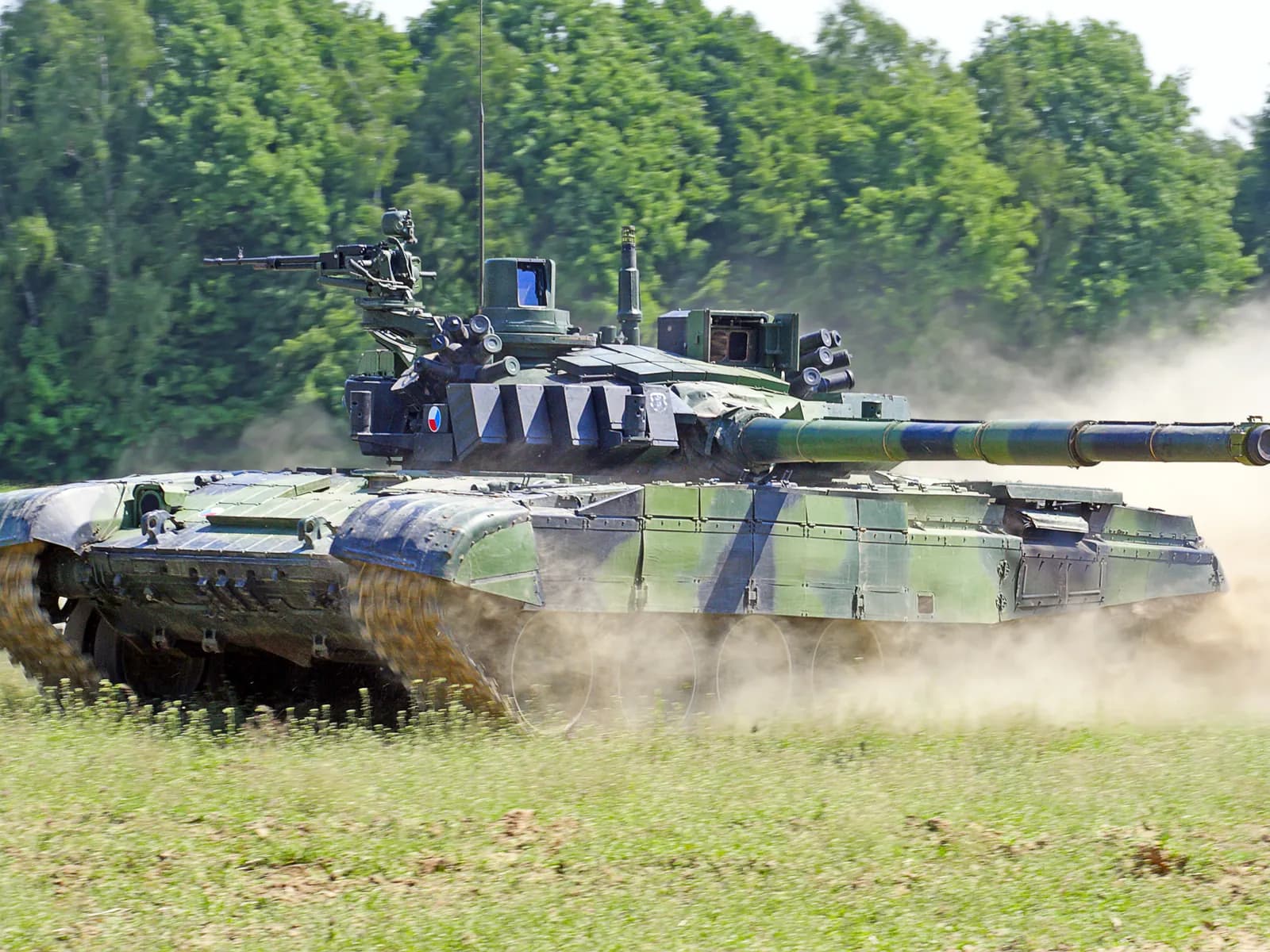
Aeron’s Land System Solutions improve the resilience and mobility of armoured security vehicles, delivering assured navigation, real-time situational awareness in GNSS-denied and RF jammed environments. Solutions go beyond navigation, adding offline maps, waypoint navigation, IFF and blue-force tracking capabilities to tactical missions.
Aeron’s Land Systems Solutions
Integrated Land System Solutions that are engineered to enhance the precision, protection, and tactical mobility of all kinds of armoured vehicles. Designed to operate in GNSS-denied and electronically contested environments, the solutions include resilient navigation systems, situational awareness technologies, precision battlefield survey tools, and control & stabilisation sensors.
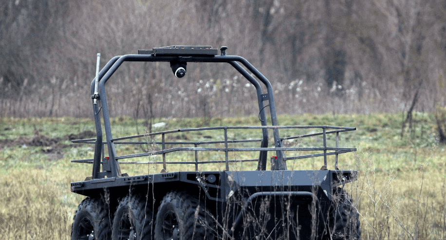
These modular, rugged solutions ensure reliable performance across wheeled and tracked vehicles including infantry fighting vehicles (IFV), mine protected vehicles (MRAPs), 4x4 and 8x8 vehicles, RCWS, EO Systems and other tactical ground platforms supporting critical missions through assured navigation, pedestal and turret stabilisation, and autonomous mobility with seamless integration and field-proven reliability.
Trusted by the world’s most respected companies
Defence and aerospace










Resilient Inertial Navigation & Situational Awareness Solutions
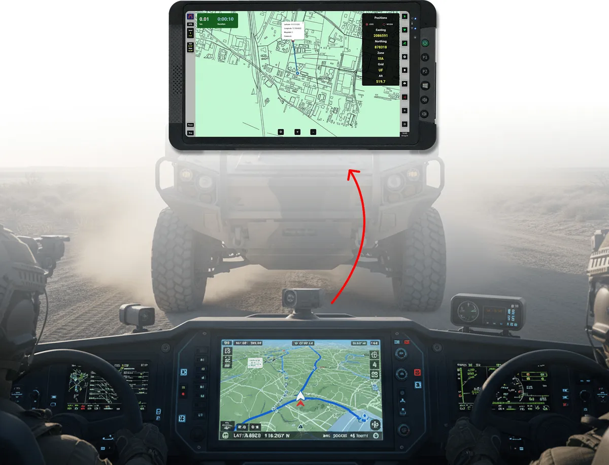
Resilient Inertial Navigation & Situational Awareness Solutions that are engineered for modern electronic warfare environments where GNSS jamming and spoofing routinely disrupt mobility and command operations. By combining high-performance MEMS-based and FOG inertial navigation, rugged multi-constellation GNSS receivers, and an integrated GIS software suite, the solution ensures continuous positioning, navigation, and full-spectrum situational awareness even in GNSS-denied and contested conditions. With heading accuracy down to 0.02° (Octantis 3 with two GNSS antennas 5 m apart) and position error of 0.5% (Aldebaran FOG INS) to under 1% (Octantis 3 MEMS INS) of distance travelled with odometer aiding, armoured platforms maintain navigational awareness and operational confidence when satellite navigation cannot be trusted.
Complementing the resilient navigation core, MIL-qualified rugged displays and situational awareness software provide commanders and crews with a unified operational picture, including Blue Force Tracking, secure text communications, electronic warfare threat indicators, and 360° situational awareness through external camera integration and route logging. Designed for deployment across wheeled and tracked fighting vehicles, armoured security vehicles, APCs, and mobile artillery systems, the system transforms combat vehicles into fully independent, mission-ready assets delivering resilient navigation, electronic warfare readiness, battlefield-proven ruggedness, and complete situational dominance in a single integrated solution.
Products
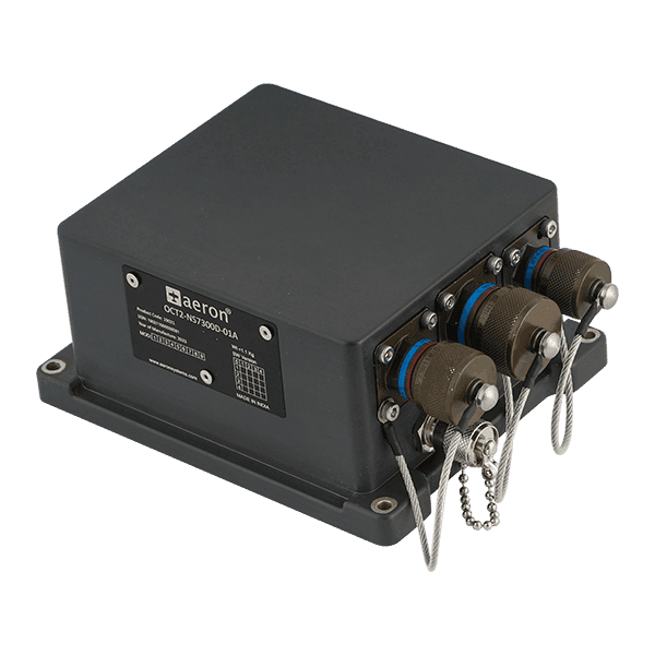 142 × 115 × 65 mmOctantis 2 INS-GNSSRugged High Reliability Inertial Navigation System for Land and Unmanned Applications
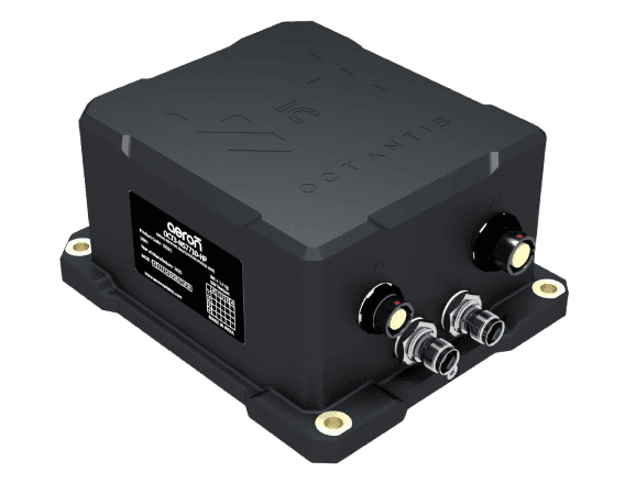 138 × 115 × 56 mmOctantis 3 INS-GNSSRugged Dual Antenna Inertial Navigation System for Unmanned and Land Applications
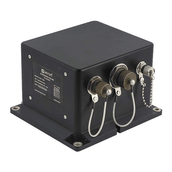 172.4 × 155 × 114 mmAldebaran FOG INS-GNSSSuperior tactical Fibre-Optic Gyro based Inertial Navigation System
Battlefield Ready Precise Positioning and Navigation Solutions
Rugged GNSS Receivers for Precision Positioning and Navigation
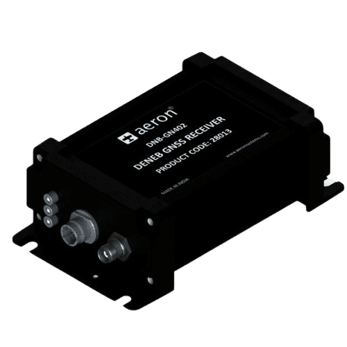
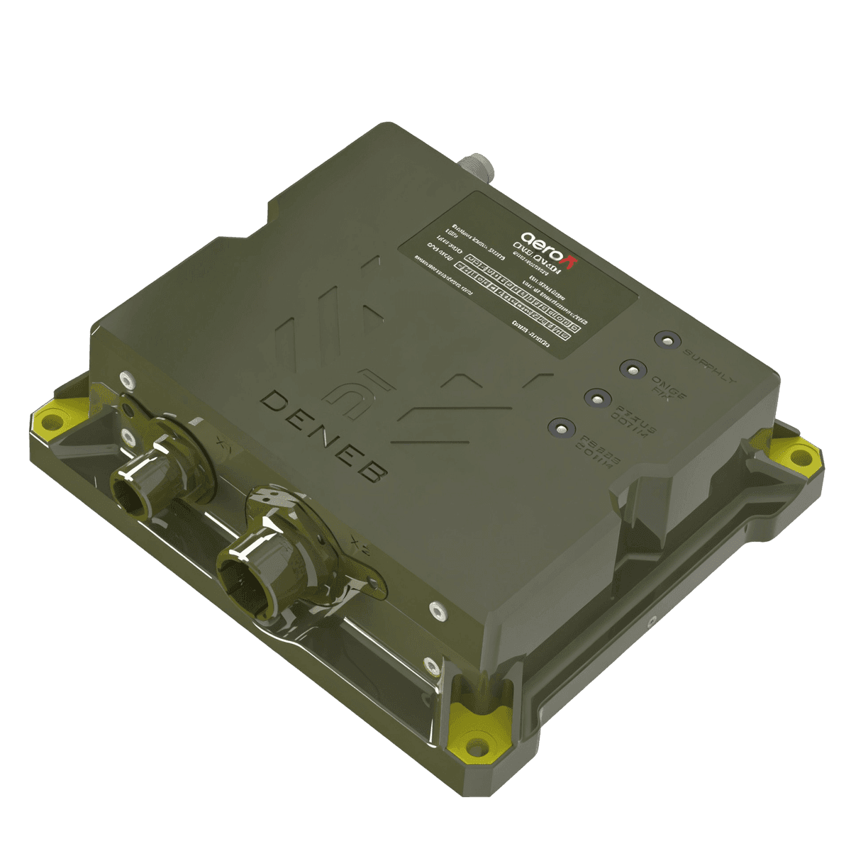
Deployment-ready positioning and navigation solutions engineered for precision, resilience, and operational reliability in the most demanding environments. The Deneb shock-hardened GNSS Receiver is built for high-shock and vibration, withstanding recoil loads up to 500g while delivering PVT (position, velocity and timing) information resilient to jamming and spoofing. The receivers are multi-frequency GNSS (L1, L2, L5) and multi-constellation with support for GPS, GALILEO, NAVIC with support for PPS timing. Supporting open architectures it enables seamless integration with command and control units, navigation equipment, turret pointing systems, making it the trusted navigation core for tactical platforms. Qualified to military standards, Deneb provides assured positioning and timing where conventional receivers fail.
For ground operations and tactical planning, Deneb supports survey grade (sub-centimetre) accuracies with RTK support. Military engineers and reconnaissance units achieve millimetre-level positioning using multi-constellation GNSS with RTK corrections, enabling fast establishment of reference points, military grids, and tactical maps. These systems are field-proven operating reliably over tens of years in extreme temperatures and terrains from ranging from the extreme heat of the Thar desert to the altitudes and low temperatures of the Himalayas.

High-Precision IMU for Mission-Critical Control
For ground operations and tactical planning, Aeron’s RTK Precision Survey Solutions deliver survey-grade geospatial intelligence with rapid deployability in contested terrain. Military engineers and reconnaissance units achieve centimeter-level accuracy using multi-constellation GNSS with secure RTK corrections, enabling fast establishment of reference points, artillery deployment grids, and tactical maps. Built to defence-grade ruggedization standards, these systems ensure uninterrupted performance across extreme environmental and electronic warfare conditions empowering mission commanders with reliable situational awareness, superior battlefield planning, and decisive operational advantage.
Optimised for diverse mission profiles, Aeron’s IMU portfolio supports a wide range of platform stabilisation use cases such as turret stabilisation, stabilisation of remote weapon stations (RCWS), electro-optic sighting systems, and RADARs operating under high-vibration and high-dynamics. Compact low-SWaP MEMS IMUs enable cost-effective stabilization for space-constrained platforms, while FOG IMUs deliver superior long-term bias stability and drift performance for armored vehicles and extended mission profiles. By combining ruggedized design with tactical-grade performance, Castor IMUs ensure reliable targeting, stable sensing, and consistent operational advantage in the harsh conditions. The Castor series IMUs have a bias instability of 1 degree per hour (typ.) while the Aldebaran FOG IMUs designed for vibration-resistance deliver bias instability ranging from 0.1 to 1 degree per hour.
Products
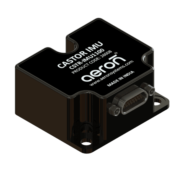 38.6 × 44.8 × 21.5 mmCastor IMU 1100Miniature Tactical 6DOF IMU with RS422 Interface
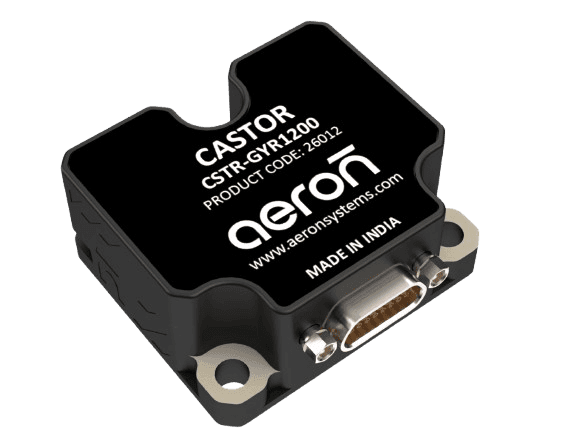 37.6 × 43.8 × 19 mmCastor GYR 1200Tactical Grade 3-Axis Gyro Module
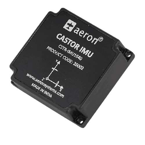 47 × 44 × 14 mmCastor IMU 1640Miniature 6DOF IMU (OEM PCB Mounted) with SPI Interface
- 172.4 × 155 × 114 mmAldebaran FOG INS-GNSSSuperior tactical Fibre-Optic Gyro based Inertial Navigation System
MEMS & FOG IMU – Utilities in Land System Applications
MEMS IMU
Lightweight, compact, and low power
Optimized for cost-effective stabilization and control
Ideal for platforms where size, weight, and power (SWaP) are critical
Used in EO sights, Camera Gimbals and RCWS
FOG IMU
Better bias performance with superior bias stability under vibration
Highly reliable for long-duration missions and harsh environments
Ideal for turret stabilization, armored vehicle sighting systems and RADARs
Provides long-term drift stability for precision targeting
Knowledge Articles
Contact
Tell one of our engineers about your land systems application and we will suggest the right products, or ask for a price.
Sales
Products, quotes and demos
Technical support
Help with an installed product
Careers
Jobs and applications
Offices
India
Head office and design centre, Pune
Plot No. 7, Lane No. 5, Laxman Nagar, Balewadi
Pune, Maharashtra 411045, India
Factory, Pune
Vivan Kohli Industrial Park, Shed No. 5, Gat No. 446
Old Pune-Mumbai Highway, Naigaon, Kanhe Phata, Talegaon
Pune, Maharashtra 412106, India
Sales and support, Bengaluru
First Floor, Building No. 11, Sai Anugraha
Jeevan Bhima Nagar Main Road
Bengaluru, Karnataka 560075, India
Sales and support, Vijayawada
Door No. 52-1/4-8D, Plot No. 9, 5th Cross Road
Veterinary Colony
Vijayawada, Andhra Pradesh 520008, India
International
Aeron Systems Pvt. Ltd., Sharjah
Saif Executive Office # P8-17-02
Sharjah Airport International Free Zone Authority
PO Box 8000, Sharjah, U.A.E.