Uncrewed Systems
Navegación miniatura sin GNSS para plataformas no tripuladas
Un sistema de navegación inercial microminiatura, de unos 38 g y menos de 1,5 W, que mantiene la navegación de UAV, UGV y vehículos de superficie no tripulados durante las pérdidas de GNSS.
The challenge
An uncrewed platform that relies on GNSS alone loses its position when the signal goes: in tunnels, in urban canyons and in zones of interference or jamming.
Drones and small robots have little room, weight or power to spare. The navigation system has to be small, light and frugal as well as accurate.
How we solve it
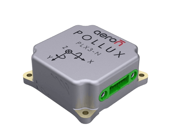
Pollux 3 is a micro-miniature MEMS inertial navigation system. It combines tri-axial accelerometers, gyroscopes and a magnetometer with an integrated multi-constellation GNSS receiver, and an Extended Kalman Filter turns them into position, velocity, attitude and heading at 200 Hz.
Small size, weight and power
37 x 37 x 15 mm, about 38 g, and under 1.5 W from a 5 V supply.
Keeps navigating without GNSS
DriftLoc minimises inertial drift when satellites vanish, holding position and true heading. With external aiding, position error is 2% of distance travelled (1σ) in 2D, and 3% in 3D with airspeed aiding.
Detects jamming and spoofing
The built-in GNSS receiver tracks GPS, GLONASS, Galileo, BeiDou and NavIC, and detects jamming and spoofing.
Plugs into the autopilot
RS232 and UART outputs in NMEA 0183 or binary, plus SPI and I2C inputs for airspeed and magnetometer aiding, for easy integration with autopilots such as ArduPilot and with controllers.
On uncrewed surface vehicles
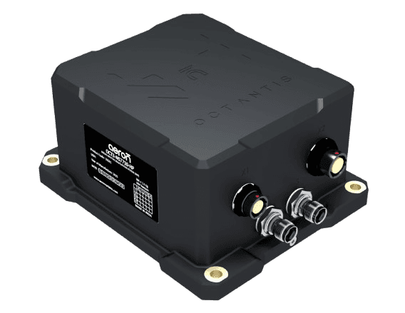
Pollux 3 serves uncrewed surface vehicles too, sealed to IP65 against water spray and rain. Where heading is needed from the outset, Octantis 3 adds dual-antenna GNSS compassing.
Key figures
- 38 gWeight
About 38 g.
- <1.5 WPower
- 200 HzNavigation output
Raw IMU data up to 1000 Hz.
- 1.5 mPosition accuracy
CEP with good GNSS, 1 m with SBAS.
Qualified to
MIL-STD-810G
Environmental tests, temperature and vibration
Where it is used
- UAVs and drones
- Unmanned ground vehiclesUGV
- Autonomous robots
- Uncrewed surface vehiclesUSV
Contacto
Tell one of our engineers about your platform and we will suggest the right product, or ask for a price.
Ventas
Productos, presupuestos y demostraciones
Soporte técnico
Ayuda con un producto instalado
Empleo
Ofertas de trabajo y solicitudes
Oficinas
India
Sede central y centro de diseño, Pune
Plot No. 7, Lane No. 5, Laxman Nagar, Balewadi
Pune, Maharashtra 411045, India
Planta de fabricación, Pune
Vivan Kohli Industrial Park, Shed No. 5, Gat No. 446
Old Pune-Mumbai Highway, Naigaon, Kanhe Phata, Talegaon
Pune, Maharashtra 412106, India
Ventas y soporte, Bengaluru
First Floor, Building No. 11, Sai Anugraha
Jeevan Bhima Nagar Main Road
Bengaluru, Karnataka 560075, India
Ventas y soporte, Vijayawada
Door No. 52-1/4-8D, Plot No. 9, 5th Cross Road
Veterinary Colony
Vijayawada, Andhra Pradesh 520008, India
Internacional
Aeron Systems Pvt. Ltd., Sharjah
Saif Executive Office # P8-17-02
Sharjah Airport International Free Zone Authority
PO Box 8000, Sharjah, U.A.E.